MANILA, Philippines – 'Bagyong Ineng' maintains its strength while moving westward, state weather bureau PAGASA announced in its 11:00 am bulletin on Tuesday, September 5, 2023.
Earlier, PAGASA said that the low pressure area east of extreme Northern Luzon has developed into tropical depression Ineng, the ninth cyclone in the country this year.
At 10:00 am today, Ineng was estimated based on all available data at 975 km East of Extreme Northern Luzon. It has maximum sustained winds of 45 km/h near the center, gustiness of up to 55 km/h, and central pressure of 1002 hPa. Strong winds extend outwards up to 150 km from the center.
TROPICAL CYCLONE WIND SIGNALS (TCWS) IN EFFECT
No Wind Signal hoisted at this time.
TRACK AND INTENSITY OUTLOOK
Ineng is forecast to remain far from the Philippine landmass. Tracking generally northeastward or north northeastward while gradually intensifying throughout forecast period, it may exit the Philippine Area of Responsibility tonight or tomorrow as a tropical storm.
Outside the PAR region, Ineng will continue in its northeastward or north northeastward movement towards the waters south of mainland Japan.
HAZARDS AFFECTING LAND AREAS
Tropical Depression Ineng is not directly affecting the country, although it is slightly enhancing the Southwest Monsoon (alongside Tropical Storm Haiku, which enhances it more).
The enhanced monsoon will bring occasional to monsoon rains over the western portions of Luzon in the next three days.
HAZARDS AFFECTING COASTAL WATERS
Ineng is less likely to bring rough sea conditions over any seaboard of the country through the forecast period. However, due to the Southwest Monsoon that it is slightly enhancing, a Gale Warning is in effect for the seaboards of Northern Luzon, the western seaboard of Central Luzon, the western and southern seaboards of Southern Luzon, and the western seaboard of Visayas.
TROPICAL CYCLONES
On average, there are 20 tropical cyclones that could form or enter the PAR each year. Only half of those are projected to make landfall.
SEE ALSO: LIST: Typhoon, tropical cyclone names in the Philippines 2023
— The Summit Express
Earlier, PAGASA said that the low pressure area east of extreme Northern Luzon has developed into tropical depression Ineng, the ninth cyclone in the country this year.
 |
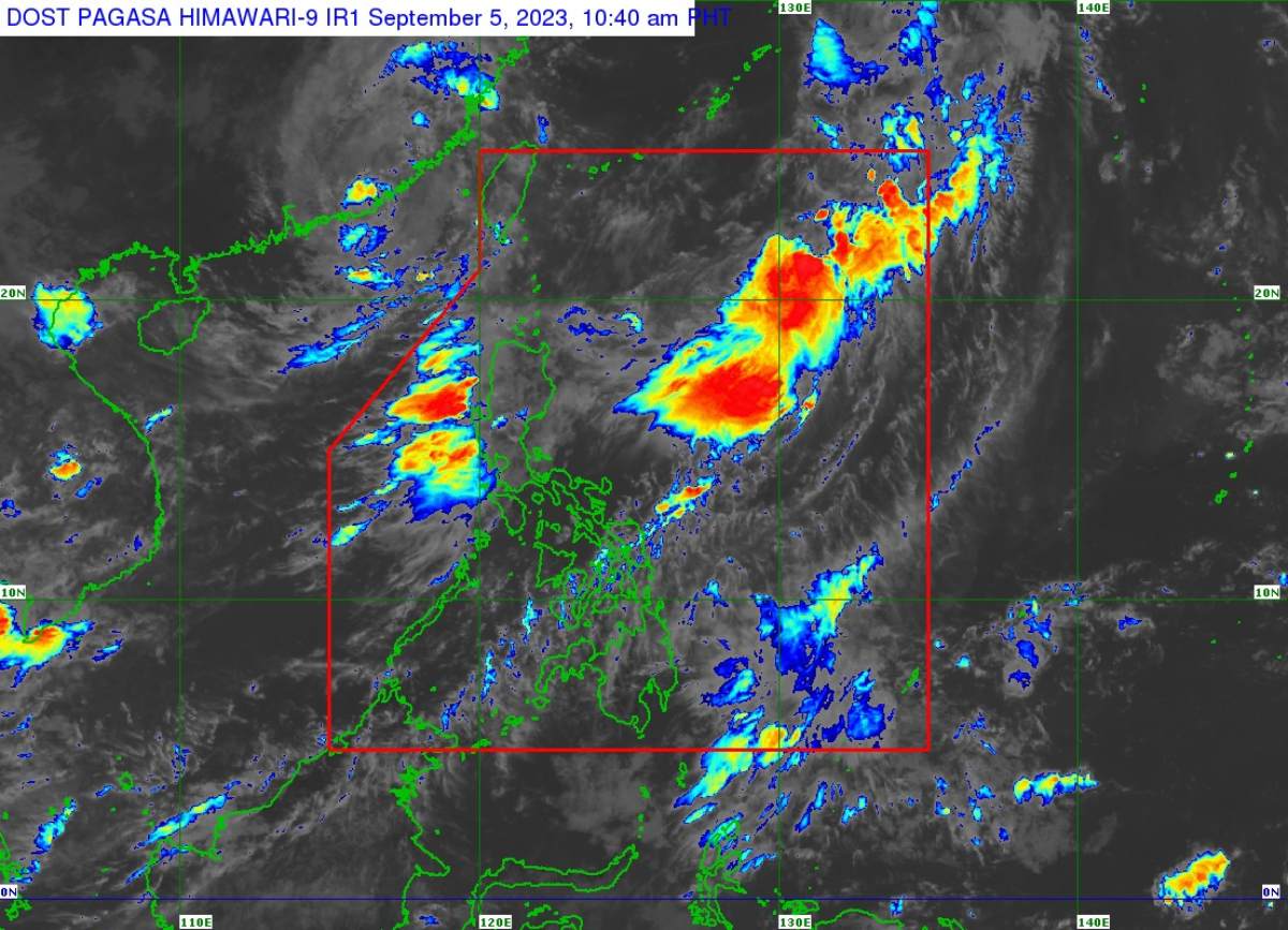
| Satellite image of 'Bagyong Ineng' as of September 5, 2023 10:40 am. Photo courtesy of PAGASA |
At 10:00 am today, Ineng was estimated based on all available data at 975 km East of Extreme Northern Luzon. It has maximum sustained winds of 45 km/h near the center, gustiness of up to 55 km/h, and central pressure of 1002 hPa. Strong winds extend outwards up to 150 km from the center.
TROPICAL CYCLONE WIND SIGNALS (TCWS) IN EFFECT
No Wind Signal hoisted at this time.
TRACK AND INTENSITY OUTLOOK
Ineng is forecast to remain far from the Philippine landmass. Tracking generally northeastward or north northeastward while gradually intensifying throughout forecast period, it may exit the Philippine Area of Responsibility tonight or tomorrow as a tropical storm.
Outside the PAR region, Ineng will continue in its northeastward or north northeastward movement towards the waters south of mainland Japan.
HAZARDS AFFECTING LAND AREAS
Tropical Depression Ineng is not directly affecting the country, although it is slightly enhancing the Southwest Monsoon (alongside Tropical Storm Haiku, which enhances it more).
The enhanced monsoon will bring occasional to monsoon rains over the western portions of Luzon in the next three days.
HAZARDS AFFECTING COASTAL WATERS
Ineng is less likely to bring rough sea conditions over any seaboard of the country through the forecast period. However, due to the Southwest Monsoon that it is slightly enhancing, a Gale Warning is in effect for the seaboards of Northern Luzon, the western seaboard of Central Luzon, the western and southern seaboards of Southern Luzon, and the western seaboard of Visayas.
TROPICAL CYCLONES
On average, there are 20 tropical cyclones that could form or enter the PAR each year. Only half of those are projected to make landfall.
SEE ALSO: LIST: Typhoon, tropical cyclone names in the Philippines 2023
— The Summit Express

