MANILA, Philippines – Tropical Storm 'Khanun' has entered the Philippine Area of Responsibility (PAR) and was locally named 'Falcon', the sixth tropical cyclone for 2023, state weather bureau PAGASA announced in its 5:00 am bulletin on Saturday, July 29, 2023.
At 4:00 am today, the center of the eye of Tropical Storm 'Falcon' was estimated based on all available data at 1,360 km East of Central Luzon.
SEE ALSO: 'Bagyong Falcon' PAGASA weather update July 30, 2023
 |
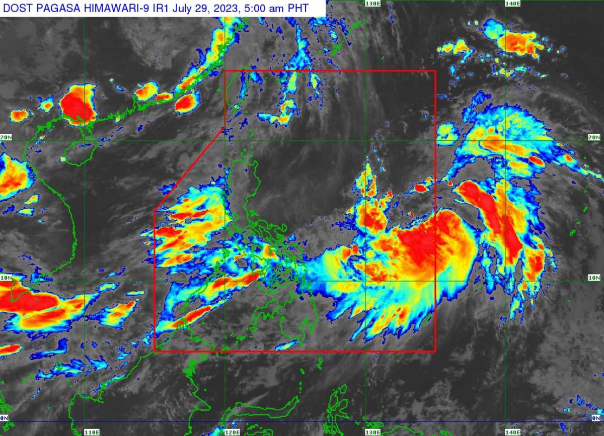
| Satellite image of 'Bagyong Falcon' as of 5:00 am, July 29, 2023. Photo courtesy of DOST-PAGASA |
At 4:00 am today, the center of the eye of Tropical Storm 'Falcon' was estimated based on all available data at 1,360 km East of Central Luzon.
SEE ALSO: 'Bagyong Falcon' PAGASA weather update July 30, 2023
TS 'Falcon' has maximum sustained winds of 65 km/h near the center, gustiness of up to 80 km/h, and central pressure of 998 hPa. It is moving west northwestward at 15 km/h.
Strong to gale-force winds extend outwards up to 700 km from the center.
TRACK AND INTENSITY OUTLOOK
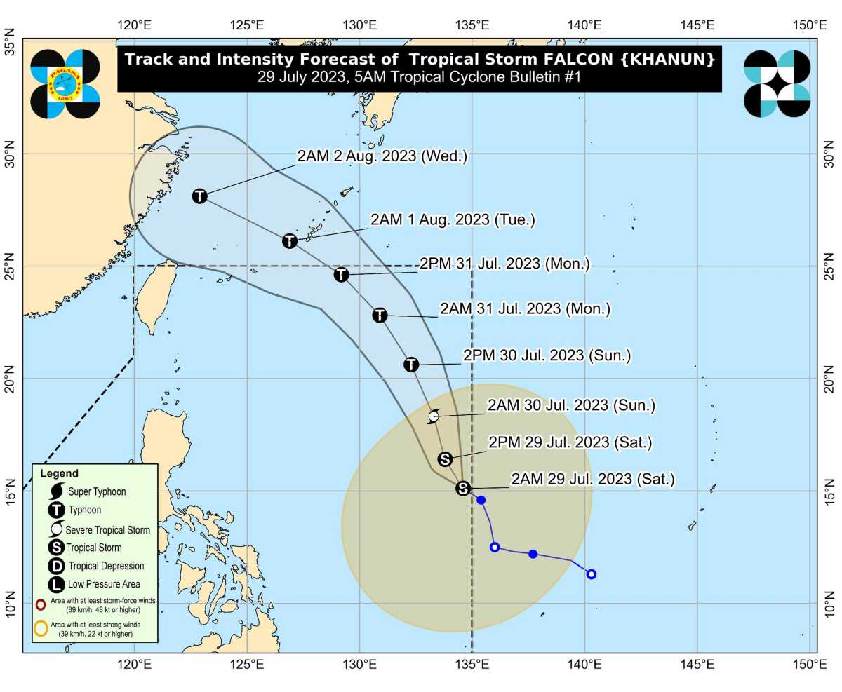
TS 'Falcon' is forecast to move generally north northwestward today through tomorrow, then turn northwestward on Monday.
This tropical cyclone will remain over the Philippine Sea and far from the Philippine landmass throughout the forecast period.
On the track forecast, 'Falcon' may exit the PAR region between Monday afternoon and Monday evening. Outside the PAR region, this tropical cyclone will turn west northwestward, pass very close or make landfall in the Okinawa Islands of the Ryukyu Archipelago between Monday evening and Tuesday morning, and move over the East China Sea towards the east coast of China.
The storm is forecast to intensify within the next 3 days. It is forecast to become a typhoon tomorrow afternoon or evening and reach its peak intensity on late Monday or early Tuesday.
HAZARDS AFFECTING LAND AREAS
The Southwest Monsoon currently enhanced by Tropical Storm 'Egay' (currently over mainland China) will also be enhanced by Tropical Storm 'Falcon' starting this weekend, bringing occasional to monsoon rains over the western portions of Luzon and Visayas in the next three days.
The hoisting of Wind Signal due to FALCON over any locality in the country remains unlikely based on the current forecast scenario, PAGASA said.
HAZARDS AFFECTING COASTAL WATERS
Under the influence of the enhanced Southwest Monsoon and Tropical Storm 'Falcon', a Gale Warning is in effect over several coastal waters along the western seaboard of Luzon, the eastern and southern seaboards of Southern Luzon, and the eastern and western seaboards of Visayas.
TROPICAL CYCLONES
On average, there are 20 tropical cyclones that could form or enter the PAR each year. Only half of those are projected to make landfall.
— The Summit Express

