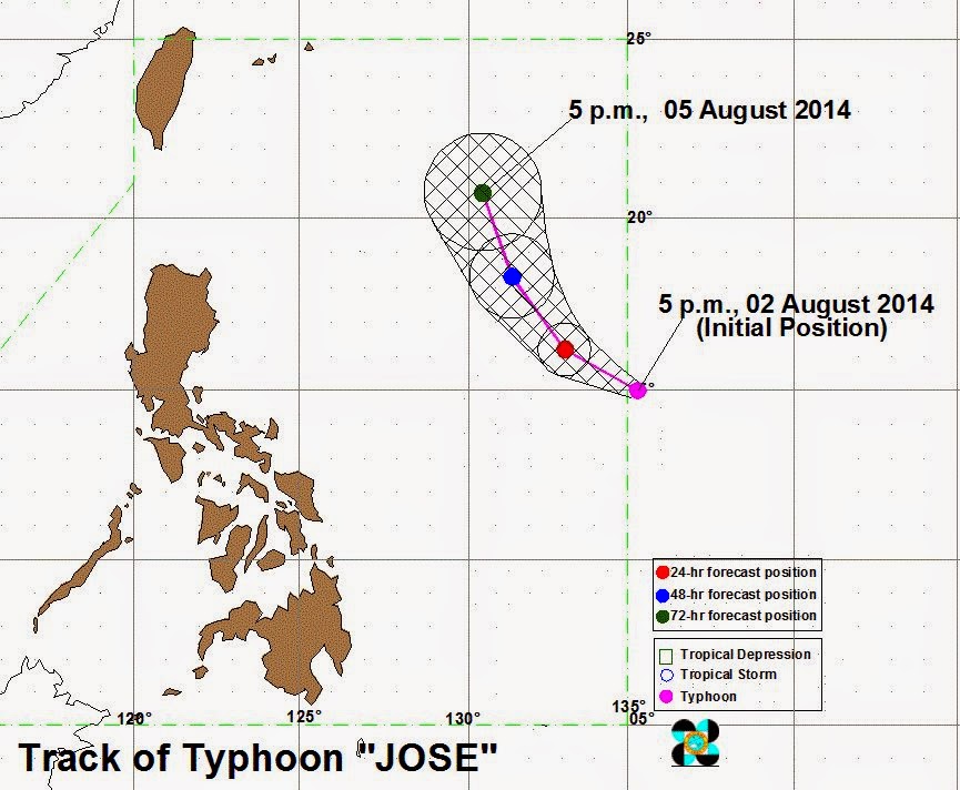
Manila, Philippines - State weather bureau PAGASA announces Saturday night, August 2, 2014 that the typhoon at East of Central Luzon has entered the Philippine Area of Responsibility (PAR) and was named “Jose” (international name: Halong).
At 7:00 PM today, the eye of 'Bagyong Jose' was located based on all available data at 1,250 km East of Casiguran, Aurora (15.0°N, 135.0°E).
August 3 Update: PAGASA: 'Bagyong Jose' gains more strength, moves northwest
'Bagyong Jose' has a maximum sustained winds of 160 kph near the center and gustiness of up to 195 kph. It is forecast to move West Northwest at 11 kph.
Typhoon Jose is expected to be at 1,060 km East of Casiguran, Aurora by tomorrow afternoon (August 3) and at 940 km East of Tuguegarao City by Monday afternoon (August 4). By Tuesday afternoon, it is expected to be at 810 km East of Basco, Batanes.
The estimated rainfall amount is from 10 – 25 mm per hour (heavy - intense) within the 650 km diameter of the Typhoon.
Typhoon Jose will not yet affect any part of the country. However, the Southwest Monsoon (Habagat) will bring occasional rains over Metro Manila, Central Luzon, Ilocos Region, CALABARZON and MIMAROPA.
The public and the disaster risk reduction and management council concerned are advised to take appropriate actions and watch for the next bulletin.

